
 There are approximately 1,682,048 acres in Gallatin County including over 16,500 acres in surface water.
Approximately 800,000 acres in Gallatin County are owned by the public and managed by several local and national agencies including the Bureau of Land Management, U.S. Forest Service, National Park Service, Montana Fish Wildlife & Parks, Montana Department of Transportation, Department of Natural Resources & Conservation and various local governments.
The southern end of Gallatin County borders Yellowstone National Park. Yellowstone National Park is 2,219,791 acres in size and borders the 310,000 acre Grand Teton National Park to the south. To the west is the 254,288 acre Lee Metcalf Wilderness. To the east is the 944,000 acre Absaroka–Beartooth Wilderness.
Combined this represents the largest amount of continuous public land in the lower 48 states of the United States.
There are approximately 1,682,048 acres in Gallatin County including over 16,500 acres in surface water.
Approximately 800,000 acres in Gallatin County are owned by the public and managed by several local and national agencies including the Bureau of Land Management, U.S. Forest Service, National Park Service, Montana Fish Wildlife & Parks, Montana Department of Transportation, Department of Natural Resources & Conservation and various local governments.
The southern end of Gallatin County borders Yellowstone National Park. Yellowstone National Park is 2,219,791 acres in size and borders the 310,000 acre Grand Teton National Park to the south. To the west is the 254,288 acre Lee Metcalf Wilderness. To the east is the 944,000 acre Absaroka–Beartooth Wilderness.
Combined this represents the largest amount of continuous public land in the lower 48 states of the United States. 
Public Land Map – Gallatin County – Montana
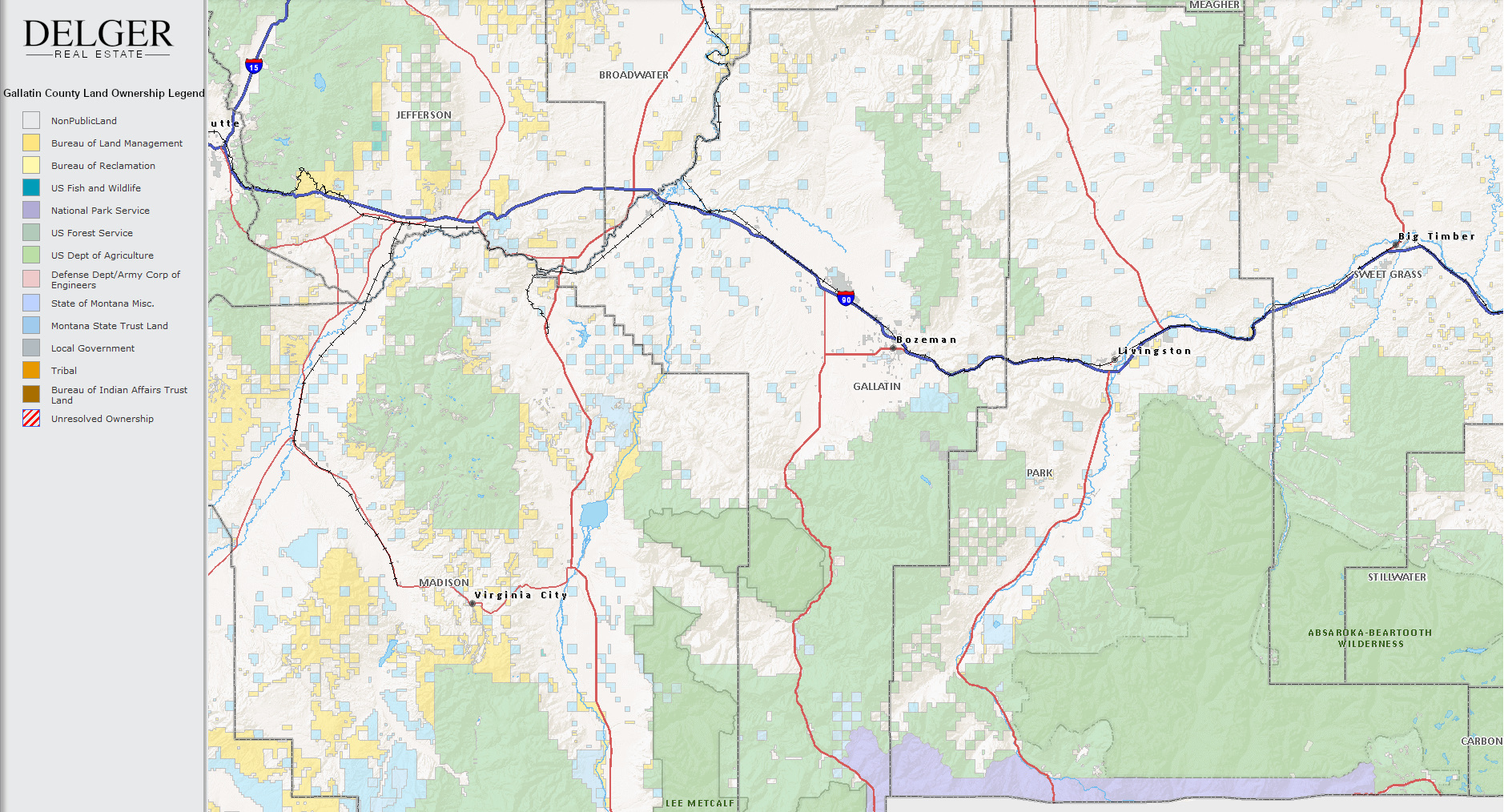
There are approximately 1,682,048 acres in Gallatin County including over 16,500 acres in surface water.
Approximately 800,000 acres in Gallatin County are owned by the public and managed by several local and national agencies including the Bureau of Land Management, U.S. Forest Service, National Park Service, Montana Fish Wildlife & Parks, Montana Department of Transportation, Department of Natural Resources & Conservation and various local governments.
The southern end of Gallatin County borders Yellowstone National Park. Yellowstone National Park is 2,219,791 acres in size and borders the 310,000 acre Grand Teton National Park to the south. To the west is the 254,288 acre Lee Metcalf Wilderness. To the east is the 944,000 acre Absaroka–Beartooth Wilderness.
Combined this represents the largest amount of continuous public land in the lower 48 states of the United States.